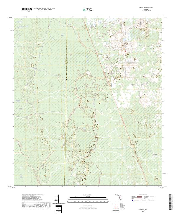
2024 Map of Bay Lake
USGS Topo · Published 2024About this map
The Little Withlacoochee River winds through a landscape defined by expansive wetlands and modern recreational pathways along the Sumter and Lake County line. This 2024 survey illustrates the conversion of historical corridors into an extensive trail network, most notably the General James A Van Fleet State Trl and the Green Swamp Bicycle Trl. These routes navigate the low-lying reaches of Head Swamp and Devils Creek Swamp, revealing a terrain where drainage and preservation are paramount.
Find a feature on this map
40 named features on this map. Tap any name to fly to it.
Don’t see what you’re looking for? This feature index may not catch every label — zoom into the map to look around manually.
Map Details
Editions of this 2024 Bay Lake Map
This is the sole edition of this map. No revisions or reprints were ever made.
Other maps of this area

1955 · Plant City
USGS Topo · 1:250,000

1955 · Orlando
USGS Topo · 1:250,000

1957 · Orlando
USGS Topo · 1:250,000

1958 · Orlando
USGS Topo · 1:250,000

1958 · Plant City
USGS Topo · 1:250,000

1958 · Webster
USGS Topo · 1:24,000

1959 · Plant City
USGS Topo · 1:250,000

1959 · Lake Nellie
USGS Topo · 1:24,000

1959 · Poyner
USGS Topo · 1:24,000

1960 · Branchborough
USGS Topo · 1:24,000