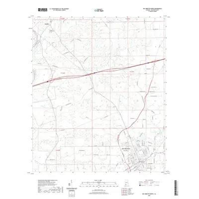
2020 Map of Bay Minette North
USGS Topo · Published 2020About this map
Stockton sits at the northwestern edge of this modern survey, marking a corridor defined by the Tensaw River and a dense network of coastal plain tributaries. The landscape is characterized by a high frequency of named watercourses, including Aikin Cr, Rains Cr, and Hollinger Cr, which cut through the terrain as it descends toward the river basin. The northern portions of the map reveal a rural land use pattern anchored by established family-named routes such as Ben Stewart Rd and Peck Thompson Rd.
Find a feature on this map
125 named features on this map. Tap any name to fly to it.
Don’t see what you’re looking for? This feature index may not catch every label — zoom into the map to look around manually.
Map Details
Editions of this 2020 Bay Minette North Map
This is the sole edition of this map. No revisions or reprints were ever made.
Other maps of this area

1941 · Bay Minette
USGS Topo · 1:62,500

1942 · Hurricane
USGS Topo · 1:31,680

1942 · Perdido
USGS Topo · 1:62,500

1942 · Dyas
USGS Topo · 1:62,500
1943 · Hurricane
USGS Topo · 1:31,680

1943 · Bay Minette
USGS Topo · 1:62,500

1943 · Tensaw
USGS Topo · 1:62,500

1944 · Tensaw
USGS Topo · 1:62,500

1944 · Dyas
USGS Topo · 1:62,500

1944 · Perdido
USGS Topo · 1:62,500