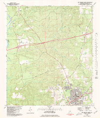
1980 Map of Bay Minette North
USGS Topo · Published 1980About this map
Bay Minette serves as the focal point of this 1980 survey, where the Louisville and Nashville railroad tracks cut through the grid of the county seat. The town's infrastructure is clearly defined, featuring the Courthouse, City Hall, and the local Armory, alongside social anchors like Holiday Park. To the northwest, the settlement of Stockton sits near the winding course of the Tensaw River and Hastie Lake, marking a transition from the urban center to a landscape dominated by timber and water.
Find a feature on this map
43 named features on this map. Tap any name to fly to it.
Don’t see what you’re looking for? This feature index may not catch every label — zoom into the map to look around manually.
Map Details
Editions of this 1980 Bay Minette North Map
This is the sole edition of this map. No revisions or reprints were ever made.
Other maps of this area

1941 · Bay Minette
USGS Topo · 1:62,500

1942 · Hurricane
USGS Topo · 1:31,680

1942 · Perdido
USGS Topo · 1:62,500

1942 · Dyas
USGS Topo · 1:62,500
1943 · Hurricane
USGS Topo · 1:31,680

1943 · Bay Minette
USGS Topo · 1:62,500

1943 · Tensaw
USGS Topo · 1:62,500

1944 · Tensaw
USGS Topo · 1:62,500

1944 · Dyas
USGS Topo · 1:62,500

1944 · Perdido
USGS Topo · 1:62,500