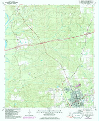
1986 Map of Bay Minette North
USGS Topo · Published 1986About this map
Bay Minette serves as the focal point for this mid-1980s survey, showing the town as it expanded northward along the Seaboard rail line. The map highlights a community-centered landscape, with the Courthouse, City Hall, and Infirmary anchoring the southern edge of the sheet. To the northwest, the settlement of Stockton sits near the winding course of the Tensaw River, its local heritage marked by the Stockton Memorial Cem. The area between these hubs is defined by a dense network of waterways like Rains Creek and Godbolt Creek, alongside spiritual landmarks such as Cottage Hill Ch and Driftwood Ch. This edition includes purple revision overlays from 1985, documenting subtle changes in woodland and infrastructure since the primary 1976 photogrammetric survey.
Find a feature on this map
42 named features on this map. Tap any name to fly to it.
Don’t see what you’re looking for? This feature index may not catch every label — zoom into the map to look around manually.
Map Details
Editions of this 1986 Bay Minette North Map
This is the sole edition of this map. No revisions or reprints were ever made.
Other maps of this area

1941 · Bay Minette
USGS Topo · 1:62,500

1942 · Hurricane
USGS Topo · 1:31,680

1942 · Perdido
USGS Topo · 1:62,500

1942 · Dyas
USGS Topo · 1:62,500
1943 · Hurricane
USGS Topo · 1:31,680

1943 · Bay Minette
USGS Topo · 1:62,500

1943 · Tensaw
USGS Topo · 1:62,500

1944 · Tensaw
USGS Topo · 1:62,500

1944 · Dyas
USGS Topo · 1:62,500

1944 · Perdido
USGS Topo · 1:62,500