Loading...
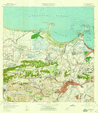
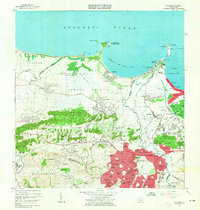
Loading map...1957 Map of Bayamon
USGS Topo · Published 1959This historical map portrays the area of Bayamon in 1957, primarily covering Bayamón Municipio as well as portions of San Juan Municipio, Guaynabo Municipio, Toa Baja Municipio, Cataño Municipio, Dorado Municipio, and Toa Alta Municipio. Featuring a scale of 1:20000, this map provides a highly detailed snapshot of the terrain, roads, buildings, counties, and historical landmarks in the Bayamon region at the time. Published in 1959, it is the sole known edition of this map.
Find a feature on this map
111 named features on this map. Tap any name to fly to it.
Don’t see what you’re looking for? This feature index may not catch every label — zoom into the map to look around manually.
Map Details
Date Portrayed1957
Date Published1959
PublisherU.S. Geological Survey
Map TypeTopographic
Scale1:20000
Physical Dimensions28.1 x 32.3 inches
Editions of this 1957 Bayamon Map
This is the sole edition of this map. No revisions or reprints were ever made.
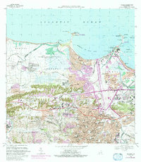
Historical Maps of Parque del Lago Through Time
7 maps found

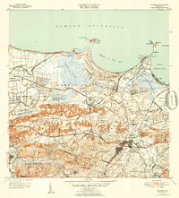
Featured Locations
- Parque del Lago, Toa Baja
- Sector La Arena, Toa Alta
- Toa Alta, Toa Alta
- Bayamón, Bayamón
- Sector del Conuco, Bayamón
Source Details
SourceU.S. Geological Survey
CopyrightPublic Domain