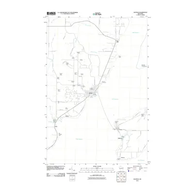
2010 Map of Bayfield
USGS Topo · Published 2010About this map
Bayfield serves as the focal point for this survey of the Lake Superior shoreline, where the historic Old Bayfield County Courthouse stands as a reminder of the town's administrative past. The landscape is defined by its agricultural heritage, evidenced by a dense network of fruit-growing operations such as Superior View Orchard, Erickson Orchard, and Rabideaux Orchard. To the north, the Red Cliff community overlooks the water near Chicago Creek and Brickyard Creek, while the southwestern shore features the Bayfield State Fish Hatchery at Salmo.
Find a feature on this map
72 named features on this map. Tap any name to fly to it.
Don’t see what you’re looking for? This feature index may not catch every label — zoom into the map to look around manually.
Map Details
Editions of this 2010 Bayfield Map
This is the sole edition of this map. No revisions or reprints were ever made.
Other maps of this area

1941 · Bayfield
USGS Topo · 1:48,000

1942 · Ashland
USGS Topo · 1:48,000

1943 · Odanah
USGS Topo · 1:48,000

1945 · Odanah
USGS Topo · 1:48,000

1946 · Bayfield
USGS Topo · 1:48,000

1947 · Ashland
USGS Topo · 1:48,000

1953 · Ashland
USGS Topo · 1:250,000

1958 · Ashland
USGS Topo · 1:250,000

1963 · Oak Island
USGS Topo · 1:24,000
1964 · Sand Island
USGS Topo · 1:24,000