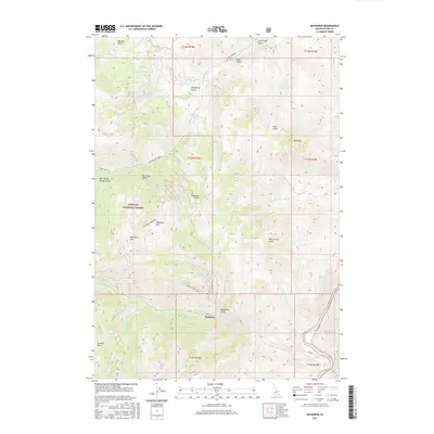
2017 Map of Bayhorse
USGS Topo · Published 2017About this map
Bayhorse is the central point of interest on this 2017 survey, situated at the junction of Bayhorse Cr and Beardsley Gulch. This high-altitude landscape in the Challis National Forest is defined by its mining heritage, as evidenced by names like Keystone Mtn, Ramshorn Mtn, and the Pacific Mines Trail. The terrain is deeply incised by numerous gulches such as Merrimac Gulch and Bull of the Woods Gulch, while the Salmon River cuts through the southeastern corner of the quadrangle. Transportation into the interior is marked by the Keystone-Ramshorn route and Buster Lake Road, providing access to high points like Blue Mtn. The presence of Daugherty Spring and Juliette Basin highlights the complex hydrology and varied topography that have shaped the land-use patterns in this part of Custer County.
Find a feature on this map
34 named features on this map. Tap any name to fly to it.
Don’t see what you’re looking for? This feature index may not catch every label — zoom into the map to look around manually.
Map Details
Editions of this 2017 Bayhorse Map
This is the sole edition of this map. No revisions or reprints were ever made.
Other maps of this area

1929 · Bayhorse
USGS Topo · 1:125,000

1956 · Challis
USGS Topo · 1:62,500

1956 · Twin Peaks
USGS Topo · 1:62,500

1957 · Challis
USGS Topo · 1:250,000

1960 · Challis
USGS Topo · 1:250,000

1963 · Challis
USGS Topo · 1:250,000

1963 · Bald Mountain
USGS Topo · 1:24,000

1963 · Bayhorse Lake
USGS Topo · 1:24,000

1963 · Bayhorse
USGS Topo · 1:24,000

1963 · Clayton
USGS Topo · 1:24,000