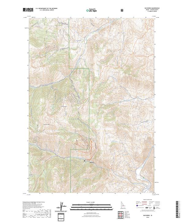
2024 Map of Bayhorse
USGS Topo · Published 2024About this map
Bayhorse is the central fixture of this survey, set within the deep drainages of the Challis National Forest. The map documents a landscape defined by its mining history and steep topography, where the Bayhorse Creek valley meets the heights of Keystone Mtn and Ramshorn Mtn. Local family history and industrial roots are visible at the Bayhorse Cem and through an extensive network of historic access routes, including the Pacific Mines Trl, Sherman Lode Trl, and the Keystone-Ramshorn Trl. The eastern edge of the quadrangle descends toward the Salmon River, where the Centennial Flat Rd follows the river corridor. These labels trace the development of high-elevation resource extraction, from the isolated Juliette Basin to the various gulches like Beardsley Gulch and Keystone Gulch that once supported the local economy.
Find a feature on this map
43 named features on this map. Tap any name to fly to it.
Don’t see what you’re looking for? This feature index may not catch every label — zoom into the map to look around manually.
Map Details
Editions of this 2024 Bayhorse Map
This is the sole edition of this map. No revisions or reprints were ever made.
Other maps of this area

1929 · Bayhorse
USGS Topo · 1:125,000

1956 · Challis
USGS Topo · 1:62,500

1956 · Twin Peaks
USGS Topo · 1:62,500

1957 · Challis
USGS Topo · 1:250,000

1960 · Challis
USGS Topo · 1:250,000

1963 · Challis
USGS Topo · 1:250,000

1963 · Bald Mountain
USGS Topo · 1:24,000

1963 · Bayhorse Lake
USGS Topo · 1:24,000

1963 · Bayhorse
USGS Topo · 1:24,000

1963 · Clayton
USGS Topo · 1:24,000