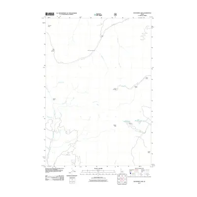
2011 Map of Bayhorse Lake
USGS Topo · Published 2011About this map
Bayhorse Lake and the smaller Little Bayhorse Lake anchor this high-elevation landscape in Custer County. The 2011 survey reveals a geography defined by access for recreation and livestock, with infrastructure like Mill Creek Campground, Bayhorse Campground, and the Cow Camp south of Trealor Creek. This is a terrain of named summits and deep drainages, where Summit Rock and Mill Creek Summit overlook the winding courses of Squaw Creek and Mill Creek. Local landmarks like Fannys Hole and the Buster Lake Dam on Garden Creek indicate a history of water management and specific place-naming. The presence of Willow Patch and the broad Juliette Basin suggest varied alpine environments used for both transit and seasonal work, connected by routes such as Mill Creek Rd and NF 045 Rd.
Find a feature on this map
32 named features on this map. Tap any name to fly to it.
Don’t see what you’re looking for? This feature index may not catch every label — zoom into the map to look around manually.
Map Details
Editions of this 2011 Bayhorse Lake Map
This is the sole edition of this map. No revisions or reprints were ever made.
Other maps of this area

1919 · Custer
USGS Topo · 1:125,000

1922 · Custer
USGS Topo · 1:125,000

1929 · Bayhorse
USGS Topo · 1:125,000

1930 · Casto
USGS Topo · 1:125,000

1956 · Twin Peaks
USGS Topo · 1:62,500

1957 · Challis
USGS Topo · 1:250,000

1960 · Challis
USGS Topo · 1:250,000

1963 · Challis
USGS Topo · 1:250,000

1963 · Challis Creek Lakes
USGS Topo · 1:24,000

1963 · Bald Mountain
USGS Topo · 1:24,000