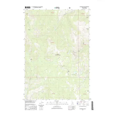
2017 Map of Bayhorse Lake
USGS Topo · Published 2017About this map
Challis National Forest dominates this Custer County interior, where a series of high-altitude basins and alpine water bodies define the drainage patterns of the Salmon River mountains. The map centers on the relationship between Buster Lake and the Bayhorse Lake complex, including Little Bayhorse Lake to the east. These high lakes are accessible via primitive routes such as Buster Lake Road and the Trealor Creek Spur 1, tracing the paths of early twentieth-century forest management and back-country recreation.
Find a feature on this map
44 named features on this map. Tap any name to fly to it.
Don’t see what you’re looking for? This feature index may not catch every label — zoom into the map to look around manually.
Map Details
Editions of this 2017 Bayhorse Lake Map
This is the sole edition of this map. No revisions or reprints were ever made.
Other maps of this area

1919 · Custer
USGS Topo · 1:125,000

1922 · Custer
USGS Topo · 1:125,000

1929 · Bayhorse
USGS Topo · 1:125,000

1930 · Casto
USGS Topo · 1:125,000

1956 · Twin Peaks
USGS Topo · 1:62,500

1957 · Challis
USGS Topo · 1:250,000

1960 · Challis
USGS Topo · 1:250,000

1963 · Challis
USGS Topo · 1:250,000

1963 · Challis Creek Lakes
USGS Topo · 1:24,000

1963 · Bald Mountain
USGS Topo · 1:24,000