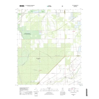
2018 Map of Bayland
USGS Topo · Published 2018About this map
Theodore Roosevelt National Wildlife Refuge and the Delta National Forest dominate this Mississippi Delta landscape at the intersection of Sharkey, Humphreys, and Yazoo Counties. The map reveals a transition between dense forest and the grid-patterned agriculture characteristic of the region. Local settlements like Bayland and Colby serve as small hubs connected by family-named routes such as Tom Miller Rd and Peter Rock Rd. For genealogists, the Valley Home Cem provides a specific point of historical reference near the eastern edge of the survey. The intricate drainage network, including Silver Creek and McCann Bayou, defines the low-lying terrain, while managed forest tracks like the Joe Blount Trail and Cypress Lake Trail offer a detailed look at the recreational and access infrastructure within the federal lands.
Find a feature on this map
42 named features on this map. Tap any name to fly to it.
Don’t see what you’re looking for? This feature index may not catch every label — zoom into the map to look around manually.
Map Details
Editions of this 2018 Bayland Map
This is the sole edition of this map. No revisions or reprints were ever made.
Other maps of this area

1939 · Lorenzen
USGS Topo · 1:62,500

1939 · Swan Lake
USGS Topo · 1:62,500

1940 · Auter
USGS Topo · 1:62,500

1953 · Greenwood
USGS Topo · 1:250,000

1955 · Jackson
USGS Topo · 1:250,000

1956 · Greenwood
USGS Topo · 1:250,000

1961 · Jackson
USGS Topo · 1:250,000

1961 · Bayland
USGS Topo · 1:62,500

1962 · Jackson
USGS Topo · 1:250,000

1964 · Lorenzen
USGS Topo · 1:62,500