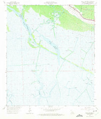
1964 Map of Bayou Cocodrie
USGS Topo · Published 1975About this map
The Intracoastal Waterway cuts a straight path through the sprawling wetlands of Terrebonne Parish, meeting the natural meanders of Bayou Cocodrie and Bayou Black. This landscape is defined by the extraction of natural resources, with extensive infrastructure including the Gibson Oil Field, Northeast Gibson Oil Field, and East Gibson Oil Field dominating the northern half of the sheet. Numerous drill holes and gas wells are scattered across the marsh, indicating the intensive industrial activity of the mid-1960s.
Find a feature on this map
23 named features on this map. Tap any name to fly to it.
Don’t see what you’re looking for? This feature index may not catch every label — zoom into the map to look around manually.
Map Details
Editions of this 1964 Bayou Cocodrie Map
3 editions found
Other maps of this area

1892 · Gibson
USGS Topo · 1:62,500

1894 · Bayou De Large
USGS Topo · 1:62,500

1897 · Gibson
USGS Topo · 1:62,500

1932 · Lake Decade
USGS Topo · 1:62,500

1935 · Theriot
USGS Topo · 1:31,680

1935 · Morgan City
USGS Topo · 1:62,500

1935 · Lake Penchant
USGS Topo · 1:31,680

1939 · Gibson
USGS Topo · 1:62,500

1940 · Bayou Du Large
USGS Topo · 1:62,500

1941 · Bayou Du Large
USGS Topo · 1:62,500