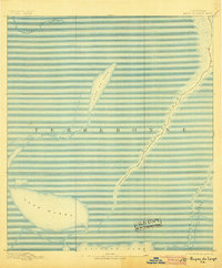
1894 Map of Bayou De Large
USGS Topo · Published 1905About this map
Bayou De Large and its surrounding wetlands dominate this coastal Louisiana landscape in a 1890 survey by Basil Duke. The map reveals the intricate hydrologic patterns of the Terrebonne region before twentieth-century coastal changes, documenting the natural course of waterways like Bayou De Cade and the expansive waters of Lake De Cade.
Find a feature on this map
9 named features on this map. Tap any name to fly to it.
Don’t see what you’re looking for? This feature index may not catch every label — zoom into the map to look around manually.
Map Details
Editions of this 1894 Bayou De Large Map
4 editions found

Other maps of this area

1892 · Gibson
USGS Topo · 1:62,500

1892 · Houma
USGS Topo · 1:62,500

1894 · Bayou De Large
USGS Topo · 1:62,500

1894 · Dulac
USGS Topo · 1:62,500

1897 · Gibson
USGS Topo · 1:62,500

1932 · Lake Decade
USGS Topo · 1:62,500

1932 · Houma SW
USGS Topo · 1:31,680

1935 · Cocodrie
USGS Topo · 1:31,680

1935 · Theriot
USGS Topo · 1:31,680

1935 · Morgan City
USGS Topo · 1:62,500