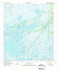
1964 Map of Bayou Du Large
USGS Topo · Published 1984About this map
Bayou du Large serves as the primary artery for settlement in this coastal marshland, where the community of Theriot and several parish institutions congregate along the natural levee. The cultural landscape is defined by its churches, including Immaculate Conception Ch, St Andrews Ch, and Bayou du Large Ch, alongside the Lower Bayou du Large Sch. This mid-century survey captures the region during a period of significant industrial expansion, evidenced by the Penchant Oil Field and the South Sunrise Oil and Gas Field.
Find a feature on this map
78 named features on this map. Tap any name to fly to it.
Don’t see what you’re looking for? This feature index may not catch every label — zoom into the map to look around manually.
Map Details
Editions of this 1964 Bayou Du Large Map
3 editions found
Other maps of this area

1892 · Gibson
USGS Topo · 1:62,500

1892 · Houma
USGS Topo · 1:62,500

1894 · Bayou De Large
USGS Topo · 1:62,500

1894 · Dulac
USGS Topo · 1:62,500

1897 · Gibson
USGS Topo · 1:62,500

1932 · Lake Decade
USGS Topo · 1:62,500

1932 · Houma SW
USGS Topo · 1:31,680

1935 · Cocodrie
USGS Topo · 1:31,680

1935 · Theriot
USGS Topo · 1:31,680

1935 · Morgan City
USGS Topo · 1:62,500