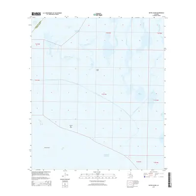
2015 Map of Bayou Lucien
USGS Topo · Published 2015About this map
Marsh Island dominates this coastal survey, showcasing the intricate network of wetlands and waterways where the waters of the Gulf of Mexico meet the mainland. The landscape is defined by its low-lying topography and tidal hydrology, featuring prominent landmarks such as Grosse Isle Point and the submerged hazard of Diamond Reef. A complex system of bayous, including Big Charles Bayou, Little Charles Bayou, and Bayou Chene, facilitates the movement of water across the marsh, reflecting the historical importance of these natural channels for navigation and local industry.
Find a feature on this map
19 named features on this map. Tap any name to fly to it.
Don’t see what you’re looking for? This feature index may not catch every label — zoom into the map to look around manually.
Map Details
Editions of this 2015 Bayou Lucien Map
This is the sole edition of this map. No revisions or reprints were ever made.
Other maps of this area

1932 · Bayou Blanc
USGS Topo · 1:31,680

1945 · New Orleans
USGS Topo · 1:250,000

1946 · Redfish Point NE
USGS Topo · 1:31,680

1946 · Redfish Point SE
USGS Topo · 1:31,680
1948 · Bayou Blanc
USGS Topo · 1:24,000

1948 · Cypremort Point
USGS Topo · 1:24,000

1949 · Cypremort Pt
USGS Topo · 1:31,680

1949 · Bayou Lucien
USGS Topo · 1:31,680
1951 · Mound Point
USGS Topo · 1:24,000
1951 · Bayou Lucien
USGS Topo · 1:24,000