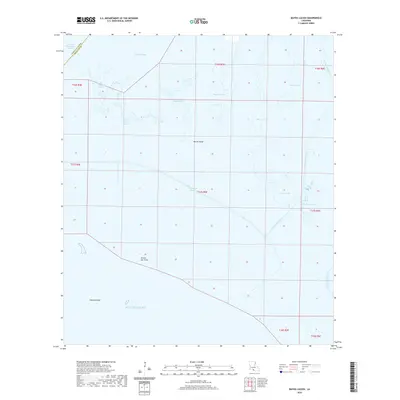
2020 Map of Bayou Lucien
USGS Topo · Published 2020About this map
Marsh Island dominates this coastal landscape where the waters of Vermilion Bay meet the Gulf of Mexico. This territory within Iberia Parish is defined by an intricate network of tidal passages, including Bayou Lucien, Bayou Chene, and Bird-Island-Bayou. The map reveals the shifting boundary between land and sea, marked by features such as Grosse Isle Point and the submerged hazards of Diamond Reef.
Find a feature on this map
25 named features on this map. Tap any name to fly to it.
Don’t see what you’re looking for? This feature index may not catch every label — zoom into the map to look around manually.
Map Details
Editions of this 2020 Bayou Lucien Map
This is the sole edition of this map. No revisions or reprints were ever made.
Other maps of this area

1932 · Bayou Blanc
USGS Topo · 1:31,680

1945 · New Orleans
USGS Topo · 1:250,000

1946 · Redfish Point NE
USGS Topo · 1:31,680

1946 · Redfish Point SE
USGS Topo · 1:31,680
1948 · Bayou Blanc
USGS Topo · 1:24,000

1948 · Cypremort Point
USGS Topo · 1:24,000

1949 · Cypremort Pt
USGS Topo · 1:31,680

1949 · Bayou Lucien
USGS Topo · 1:31,680
1951 · Mound Point
USGS Topo · 1:24,000
1951 · Bayou Lucien
USGS Topo · 1:24,000