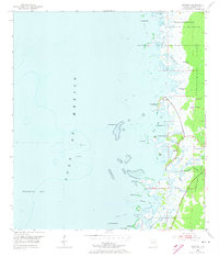
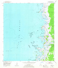
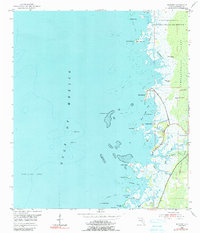
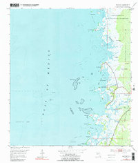
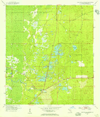
1954 Map of Bayport
USGS Topo · Published 1973About this map
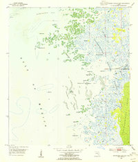
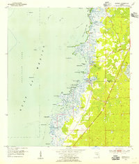
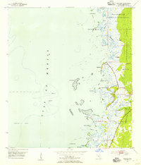
Bayport and the surrounding Hernando County coast are defined by an intricate network of tidal creeks and brackish wetlands during the mid-1950s. The landscape is dominated by the Chassahowitzka National Wildlife Refuge and the Chassahowitzka Swamp, where myriad islands like Lemon Grove Island and Wagon Wheel Island emerge from the marsh. The coastal settlements of Pine Island and Cooglers Beach sit at the edge of the Gulf of Mexico, separated from the mainland by expansive shoal lines and foul areas.
Find a feature on this map
38 named features on this map. Tap any name to fly to it.
Don’t see what you’re looking for? This feature index may not catch every label — zoom into the map to look around manually.
Map Details
Editions of this 1954 Bayport Map
5 editions found
Other maps of this area
1954 · Chassahowitzka Bay
USGS Topo · 1:24,000
1954 · Aripeka
USGS Topo · 1:24,000
1954 · Chassahowitzka
USGS Topo · 1:24,000
1954 · Bayport
USGS Topo · 1:24,000
1954 · Weekiwachee Springs
USGS Topo · 1:24,000
1954 · Port Richey NE
USGS Topo · 1:24,000

1955 · Plant City
USGS Topo · 1:250,000

1958 · Plant City
USGS Topo · 1:250,000

1959 · Plant City
USGS Topo · 1:250,000

1964 · Plant City
USGS Topo · 1:250,000