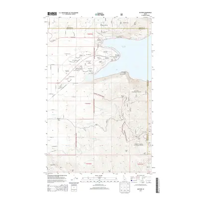
2013 Map of Bayview
USGS Topo · Published 2013About this map
Bayview serves as the primary gateway to the southern tip of Lake Pend Oreille, where a complex of recreational sites and forest land meets the water's edge. Much of the western shoreline is defined by Farragut State Park, which hosts an extensive network of campsites including Peterson Campground, Whitetail Campground, and specialized facilities like the Shooting Range. The terrain rises sharply to the east and south into the Kanisku National Forest and Coeur D'Alene National Forest, marked by prominent elevations such as Bernard Peak and Chilco Mtn. This landscape highlights the intersection of Idaho's timber heritage and its modern identity as a recreation hub, with dozens of access points like the Eagle Boat Launch and Beaver Bay Swim Area facilitating access to the deep waters of the lake.
Find a feature on this map
94 named features on this map. Tap any name to fly to it.
Don’t see what you’re looking for? This feature index may not catch every label — zoom into the map to look around manually.
Map Details
Editions of this 2013 Bayview Map
This is the sole edition of this map. No revisions or reprints were ever made.
Other maps of this area

1901 · Sandpoint
USGS Topo · 1:125,000

1903 · Rathdrum
USGS Topo · 1:125,000

1909 · Cataldo
USGS Topo · 1:125,000

1911 · Cataldo
USGS Topo · 1:125,000

1911 · Priest Lake
USGS Topo · 1:250,000

1911 · Sandpoint
USGS Topo · 1:125,000

1913 · Priest Lake
USGS Topo · 1:250,000

1949 · Packsaddle Mtn
USGS Topo · 1:62,500

1951 · Packsaddle Mtn
USGS Topo · 1:62,500

1955 · Spokane
USGS Topo · 1:250,000