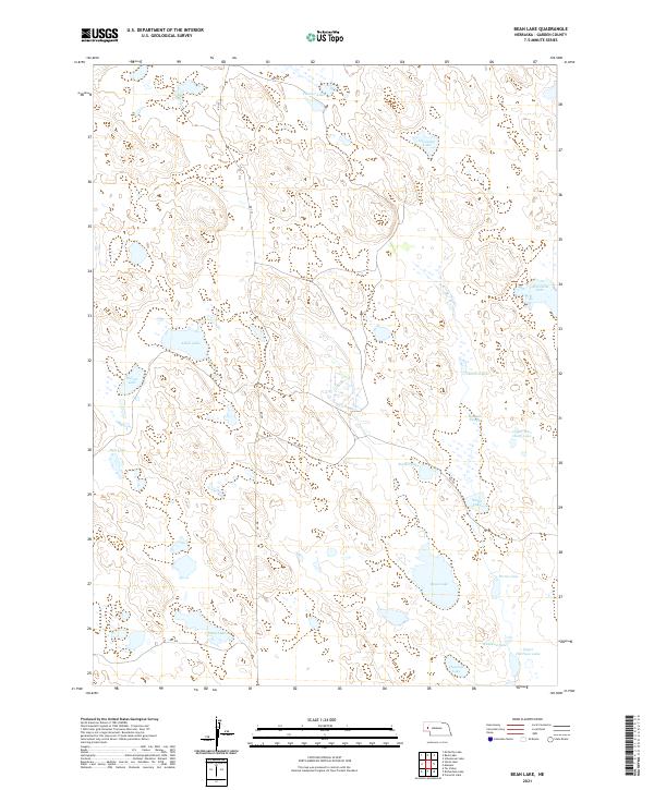
2021 Map of Bean Lake
USGS Topo · Published 2021About this map
Bean Lake and a complex network of ephemeral and semi-permanent water bodies characterize this section of the Nebraska Sandhills. The landscape is defined by its hydrography, featuring numerous basins such as Alkali Lake, Wilson Lake, and the uniquely named Old Ladys Lake. These natural features are interspersed between low dunes and depressions, reflecting the fragile hydrological balance of the region.
Find a feature on this map
26 named features on this map. Tap any name to fly to it.
Don’t see what you’re looking for? This feature index may not catch every label — zoom into the map to look around manually.
Map Details
Editions of this 2021 Bean Lake Map
This is the sole edition of this map. No revisions or reprints were ever made.
Other maps of this area

1896 · Browns Creek
USGS Topo · 1:125,000

1899 · Browns Creek
USGS Topo · 1:125,000

1949 · Mumper
USGS Topo · 1:62,500

1950 · Crescent Lake
USGS Topo · 1:62,500

1950 · Storm Lake
USGS Topo · 1:62,500

1954 · Scottsbluff
USGS Topo · 1:250,000

1958 · Scottsbluff
USGS Topo · 1:250,000

1971 · Richardson Lake
USGS Topo · 1:24,000
1971 · Tar Valley
USGS Topo · 1:24,000

1985 · Crescent Lake
USGS Topo · 1:100,000