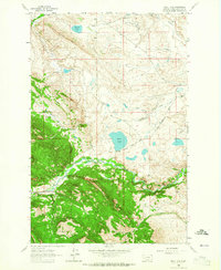
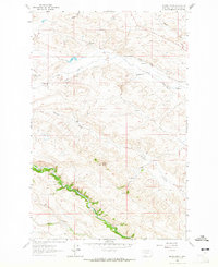
1963 Map of Bean Lake
USGS Topo · Published 1965About this map
Lewis and Clark National Forest anchors the southwestern landscape of this 1961 survey, where the terrain shifts from the high ridges of Connors Reef and Harrison Basin Ridge down toward the managed waters of the plains. The region is defined by a sophisticated network of early irrigation, including the Mosher Ditch, Carmichael Ditch, and Cuniff Ditch, which supported a cluster of established family operations such as the White Ranch, Nett Ranch, and Bean Ranch.
Find a feature on this map
36 named features on this map. Tap any name to fly to it.
Don’t see what you’re looking for? This feature index may not catch every label — zoom into the map to look around manually.
Map Details
Editions of this 1963 Bean Lake Map
This is the sole edition of this map. No revisions or reprints were ever made.
Other maps of this area

1903 · Coopers Lake
USGS Topo · 1:125,000

1943 · Hogan
USGS Topo · 1:125,000

1955 · Choteau
USGS Topo · 1:250,000

1957 · Choteau
USGS Topo · 1:250,000

1958 · Choteau
USGS Topo · 1:250,000

1962 · Choteau
USGS Topo · 1:250,000
1962 · Johnson Mountain
USGS Topo · 1:24,000
1963 · Blowout Mountain
USGS Topo · 1:24,000
1963 · Augusta
USGS Topo · 1:24,000
1963 · Krone Ranch
USGS Topo · 1:24,000