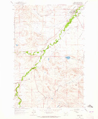
1963 Map of Augusta
USGS Topo · Published 1965About this map
Augusta serves as the focal point of this ranching-dominated landscape in Lewis and Clark County, shown here during the early 1960s. The town's local traditions are anchored by the Augusta Rodeo Ground and the Augusta Cem, while the Great Northern railroad provides the primary industrial link to the broader region. The map reveals an intricate network of water management essential to this high-plains environment, featuring the Florence Canal, Vaughn Ditch, and Mosher Ditch which divert water toward various homesteads.
Find a feature on this map
32 named features on this map. Tap any name to fly to it.
Don’t see what you’re looking for? This feature index may not catch every label — zoom into the map to look around manually.
Map Details
Editions of this 1963 Augusta Map
2 editions found
Other maps of this area

1903 · Saypo
USGS Topo · 1:125,000

1903 · Coopers Lake
USGS Topo · 1:125,000

1920 · Choteau
USGS Topo · 1:125,000

1943 · Hogan
USGS Topo · 1:125,000

1955 · Choteau
USGS Topo · 1:250,000

1957 · Choteau
USGS Topo · 1:250,000

1958 · Choteau
USGS Topo · 1:250,000

1958 · Barr Creek
USGS Topo · 1:24,000

1960 · Gilman
USGS Topo · 1:62,500

1962 · Choteau
USGS Topo · 1:250,000