
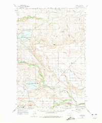
1960 Map of Gilman
USGS Topo · Published 1963About this map
Gilman lies along the banks of the Sun River, serving as a focal point for the surrounding Kirkaldie Flats and irrigation networks in the early 1960s. The landscape is defined by the heavy management of water, featuring the Pishkun National Wildlife Refuge and Willow Creek National Wildlife Refuge, both built around significant reservoirs. This era shows the intricate system of the Sun River Slope Canal and Floweree Canal diverting water across the plains to support ranching operations like the Burch Ranch and Hodgkiss Ranch.
Find a feature on this map
45 named features on this map. Tap any name to fly to it.
Don’t see what you’re looking for? This feature index may not catch every label — zoom into the map to look around manually.
Map Details
Editions of this 1960 Gilman Map
2 editions found
Other maps of this area

1903 · Saypo
USGS Topo · 1:125,000

1903 · Coopers Lake
USGS Topo · 1:125,000

1920 · Choteau
USGS Topo · 1:125,000

1943 · Hogan
USGS Topo · 1:125,000

1955 · Choteau
USGS Topo · 1:250,000

1957 · Choteau
USGS Topo · 1:250,000

1958 · Choteau
USGS Topo · 1:250,000

1958 · Lake Theboe
USGS Topo · 1:24,000

1958 · Barr Creek
USGS Topo · 1:24,000
1958 · Split Rock Lake
USGS Topo · 1:24,000