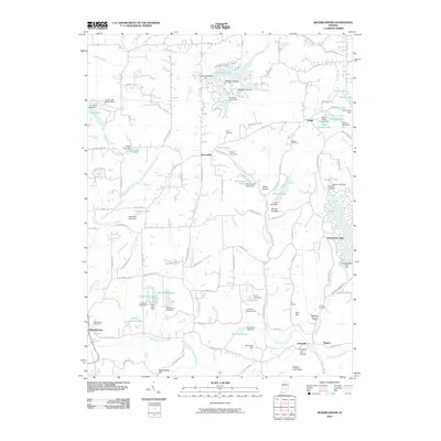
2010 Map of Beanblossom
USGS Topo · Published 2010About this map
Spearsville and Peoga anchor this rural Brown County landscape, defined by the intricate drainage of North Fork Beanblossom Creek and the North Fork Salt Creek. The area is characterized by numerous small, privately dammed water bodies, such as Little Fox Lake, Crestview Lake, and Earlham Lake, reflecting a mid-to-late 20th-century trend of creating residential and recreational impoundments within the deep hollows. Cultural landmarks are scattered throughout the wooded ridges, including the Zion Church near Zion Hill and several family-named burial grounds like Calvin Cemetery and Duncan Cemetery. Near the settlement of Beanblossom, the presence of Georgetown Cemetery suggests older community roots, while the winding paths of Bear Wallow Hill Rd and Sprunica Ridge Rd trace the local topography between prominent features like Bearwallow Hill and Panther Lick Ridge.
Find a feature on this map
135 named features on this map. Tap any name to fly to it.
Don’t see what you’re looking for? This feature index may not catch every label — zoom into the map to look around manually.
Map Details
Editions of this 2010 Beanblossom Map
This is the sole edition of this map. No revisions or reprints were ever made.
Other maps of this area

1942 · Franklin
USGS Topo · 1:125,000

1946 · Belmont
USGS Topo · 1:24,000

1947 · Nashville
USGS Topo · 1:24,000

1947 · Franklin
USGS Topo · 1:62,500

1948 · Franklin
USGS Topo · 1:24,000

1948 · New Bellsville
USGS Topo · 1:24,000

1948 · Trafalgar
USGS Topo · 1:24,000

1948 · Nineveh
USGS Topo · 1:24,000

1948 · Fruitdale
USGS Topo · 1:24,000

1948 · Morgantown
USGS Topo · 1:24,000