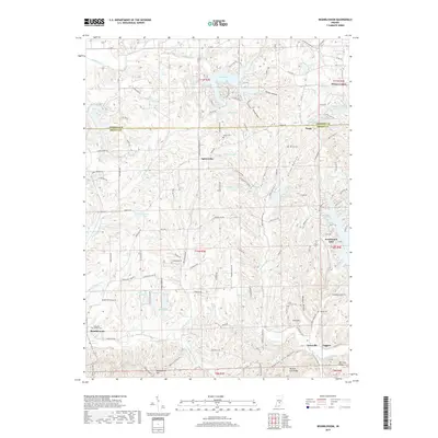
2019 Map of Beanblossom
USGS Topo · Published 2019About this map
The borderlands of Johnson and Brown Counties reveal a landscape defined by deeply incised hollows and a dense network of upland lakes in this 2019 study. Early settlement patterns are preserved in the locations of Calvin Cem, Duncan Cem, and the Zion Church Cem, while more modern development is centered around recreational waters like Lamb Lake and Sweetwater Lake. The terrain is characterized by a series of prominent ridges and drainages, including Panther Lick Ridge and Mtn Tea Ridge, which overlook the winding course of the North Fork Salt Creek. Small rural communities such as Spearsville, Peoga, and Gatesville serve as navigational anchors amidst the timbered hills. The presence of numerous small reservoirs and named hollows like Wolfpen Hollow and Rhude Hollow reflects a geography where water management and topography have dictated the pace of local growth and land use.
Find a feature on this map
104 named features on this map. Tap any name to fly to it.
Don’t see what you’re looking for? This feature index may not catch every label — zoom into the map to look around manually.
Map Details
Editions of this 2019 Beanblossom Map
This is the sole edition of this map. No revisions or reprints were ever made.
Other maps of this area

1942 · Franklin
USGS Topo · 1:125,000

1946 · Belmont
USGS Topo · 1:24,000

1947 · Nashville
USGS Topo · 1:24,000

1947 · Franklin
USGS Topo · 1:62,500

1948 · Franklin
USGS Topo · 1:24,000

1948 · New Bellsville
USGS Topo · 1:24,000

1948 · Trafalgar
USGS Topo · 1:24,000

1948 · Nineveh
USGS Topo · 1:24,000

1948 · Fruitdale
USGS Topo · 1:24,000

1948 · Morgantown
USGS Topo · 1:24,000