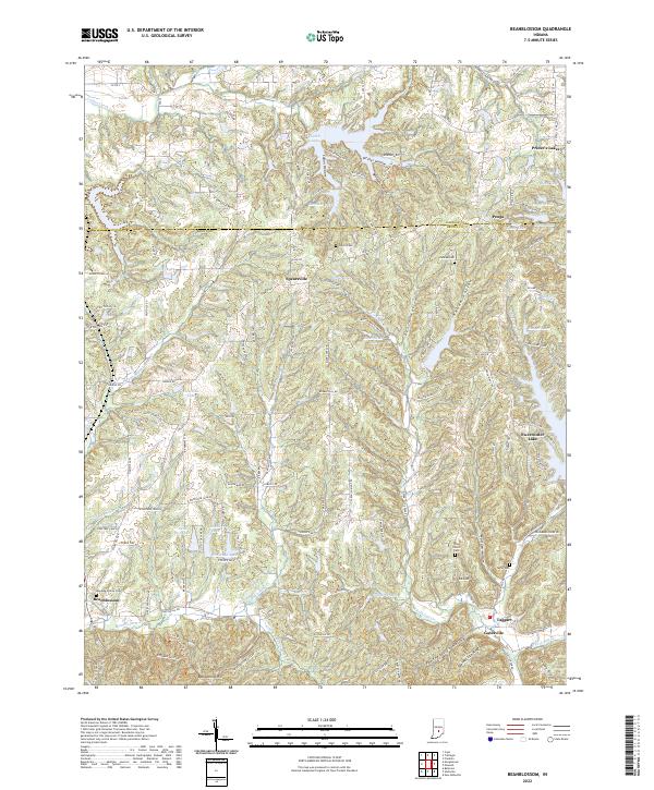
2022 Map of Beanblossom
USGS Topo · Published 2022About this map
Beanblossom sits at the southwestern edge of this landscape where Beanblossom Cr and its various forks carve through the terrain of Brown County. The geography is defined by a dense network of hollows and ridges, including Panther Lick Hollow, Pitcher Hollow, and Rhode Hollow, alongside prominent elevations like Bearwallow Hill. In the north and east, the character of the land shifts toward water-centric developments around Prince's Lakes, Lamb Lake, and Sweetwater Lake. The map reveals a dispersed settlement pattern typical of this region, connected by winding routes such as Spearsville Rd and Gatesville Rd. Local history is anchored by sites like Zion Church and the Calvin Cem, which stand alongside smaller communities like Peoga and Spearsville near the Johnson County line.
Find a feature on this map
100 named features on this map. Tap any name to fly to it.
Don’t see what you’re looking for? This feature index may not catch every label — zoom into the map to look around manually.
Map Details
Editions of this 2022 Beanblossom Map
This is the sole edition of this map. No revisions or reprints were ever made.
Other maps of this area

1942 · Franklin
USGS Topo · 1:125,000

1946 · Belmont
USGS Topo · 1:24,000

1947 · Nashville
USGS Topo · 1:24,000

1947 · Franklin
USGS Topo · 1:62,500

1948 · Franklin
USGS Topo · 1:24,000

1948 · New Bellsville
USGS Topo · 1:24,000

1948 · Trafalgar
USGS Topo · 1:24,000

1948 · Nineveh
USGS Topo · 1:24,000

1948 · Fruitdale
USGS Topo · 1:24,000

1948 · Morgantown
USGS Topo · 1:24,000