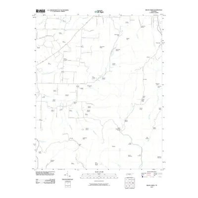
2010 Map of Beans Creek
USGS Topo · Published 2010About this map
Polly Crockett Cemetery and a high density of family burial grounds define the settled valleys of this Franklin County landscape. In the shadow of the Cumberland Plateau's western rim, agricultural life is concentrated around Motlow Cove and Buncombe Cove, where the land levels out near the headwaters of Beans Creek. This 2010 survey illustrates the deep genealogical roots of the region through landmarks like Maxwell Community Cemetery, Noah Cemetery, and Vanzandt Cemetery, many of which sit along narrow country lanes such as Walnut Grove Rd and Buncombe Rd. The drainage systems of Wilhite Creek and Dry Creek carve deep hollows into the rising terrain of Buncombe Ridge and Grassy Glade Ridge, creating a distinct topographical divide between the lower farmsteads and the higher, wooded elevations of Flat Top and Bishop Top.
Find a feature on this map
107 named features on this map. Tap any name to fly to it.
Don’t see what you’re looking for? This feature index may not catch every label — zoom into the map to look around manually.
Map Details
Editions of this 2010 Beans Creek Map
This is the sole edition of this map. No revisions or reprints were ever made.
Other maps of this area

1888 · Scottsboro
USGS Topo · 1:125,000

1892 · Scottsboro
USGS Topo · 1:125,000

1928 · Decherd
USGS Topo · 1:62,500

1936 · King Cove
USGS Topo · 1:24,000

1936 · Beans Creek
USGS Topo · 1:24,000

1936 · Hytop
USGS Topo · 1:24,000

1936 · Winchester
USGS Topo · 1:24,000

1936 · Huntland
USGS Topo · 1:24,000

1936 · Belvidere
USGS Topo · 1:24,000

1936 · Pitcher Ridge
USGS Topo · 1:24,000