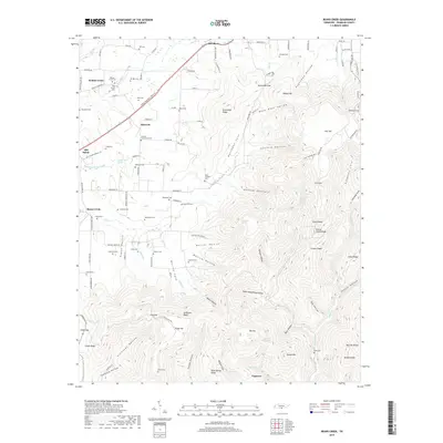
2019 Map of Beans Creek
USGS Topo · Published 2019About this map
Maxwell and the surrounding Franklin County countryside are defined by a complex network of family-named cemeteries and deep mountain coves. The terrain transitions from the rail-corridor settlements along CSX Transportation and David Crockett Pkwy W to the high elevations of Buncombe Ridge and Grassy Glade Ridge. This landscape is heavily marked by local heritage, featuring numerous small burial grounds such as Polly Crockett Cem and the Old Stovall Cem. The presence of Walnut Grove Sch and the Maxwell Community Cem indicates a well-established rural community structure. To the east, the topography becomes significantly more varied, carved by drainages like Cynthia Hollow and Gugelman Hollow, which descend from ridges into expansive natural features like Buncombe Cove.
Find a feature on this map
136 named features on this map. Tap any name to fly to it.
Don’t see what you’re looking for? This feature index may not catch every label — zoom into the map to look around manually.
Map Details
Editions of this 2019 Beans Creek Map
This is the sole edition of this map. No revisions or reprints were ever made.
Other maps of this area

1888 · Scottsboro
USGS Topo · 1:125,000

1892 · Scottsboro
USGS Topo · 1:125,000

1928 · Decherd
USGS Topo · 1:62,500

1936 · King Cove
USGS Topo · 1:24,000

1936 · Beans Creek
USGS Topo · 1:24,000

1936 · Hytop
USGS Topo · 1:24,000

1936 · Winchester
USGS Topo · 1:24,000

1936 · Huntland
USGS Topo · 1:24,000

1936 · Belvidere
USGS Topo · 1:24,000

1936 · Pitcher Ridge
USGS Topo · 1:24,000