
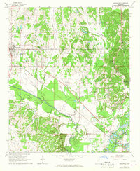
1966 Map of Beans Ferry
USGS Topo · Published 1967About this map
The Tombigbee River winds through this mid-1960s landscape, flanked by numerous small settlements and family landmarks in Itawamba County. Near the crossing at Beans Ferry, the terrain is defined by a dense network of watercourses, including Reeds Creek and Mantachie Creek. The map documents a rural society anchored by local institutions, such as Big Oak Ch and Hopewell Ch, alongside several family burying grounds like Bean Cem and Wiygul Cem. The presence of the Mantachie Lookout Tower and a Drive-in Theater near Fulton highlights the era's infrastructure and community gathering points. This survey captures the region just before significant changes to the river system, preserving the original channel and the scattered communities of Abney, Van Buren, and Cardsville along its banks.
Find a feature on this map
36 named features on this map. Tap any name to fly to it.
Don’t see what you’re looking for? This feature index may not catch every label — zoom into the map to look around manually.
Map Details
Editions of this 1966 Beans Ferry Map
This is the sole edition of this map. No revisions or reprints were ever made.
Other maps of this area

1921 · Tupelo
USGS Topo · 1:48,000

1923 · Tupelo
USGS Topo · 1:62,500

1956 · Tupelo
USGS Topo · 1:250,000

1958 · Tupelo
USGS Topo · 1:250,000

1965 · Mooreville
USGS Topo · 1:24,000

1965 · Fulton SE
USGS Topo · 1:24,000

1965 · Fulton
USGS Topo · 1:24,000

1966 · Smithville
USGS Topo · 1:24,000

1966 · Turon
USGS Topo · 1:24,000
1966 · Nettleton
USGS Topo · 1:24,000