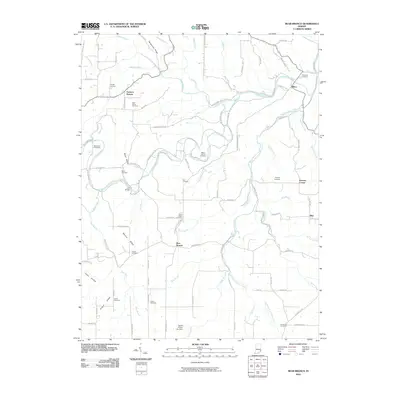
2010 Map of Bear Branch
USGS Topo · Published 2010About this map
Farmers Retreat and the high ground of Sangamaw Ridge define the northern reaches of this Dearborn County landscape, where deep hollows like Posky Hollow and Baum Hollow drop away from the surrounding agricultural plateaus. The region is characterized by its numerous family and parish burial grounds, including the Mount Hebron Cemetery, Pate Cemetery, and Cooper Cemetery, which offer a clear record of local settlement patterns. Winding watercourses such as Laughery Creek and its many tributaries, including South Fork Laughery Creek and Mud Lick Creek, have historically dictated the placement of roads and small communities like Milton and Bear Branch. Significant local landmarks like Pruss Airport and the Daniel D Bray Lake Dam contrast with the rural character of the terrain. The presence of Lost Bridge and various ridges like Mexico Ridge and Chapel Ridge further illustrate the deeply dissected topography of this southeastern Indiana corner.
Find a feature on this map
102 named features on this map. Tap any name to fly to it.
Don’t see what you’re looking for? This feature index may not catch every label — zoom into the map to look around manually.
Map Details
Editions of this 2010 Bear Branch Map
This is the sole edition of this map. No revisions or reprints were ever made.
Other maps of this area

1915 · Lawrenceburg
USGS Topo · 1:48,000

1928 · Lawrenceburg
USGS Topo · 1:62,500

1932 · Lawrenceburg
USGS Topo · 1:62,500

1943 · Florence
USGS Topo · 1:24,000

1943 · Aberdeen
USGS Topo · 1:24,000

1943 · Aurora
USGS Topo · 1:24,000

1943 · Vevay North
USGS Topo · 1:24,000

1946 · Milan
USGS Topo · 1:24,000

1951 · Florence
USGS Topo · 1:24,000

1953 · Aberdeen
USGS Topo · 1:24,000