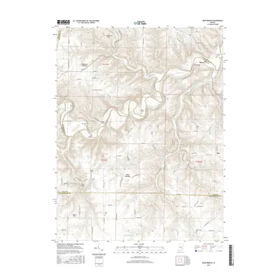
2016 Map of Bear Branch
USGS Topo · Published 2016About this map
Laughery Creek and its many tributaries, including South Fork Laughery Creek and Bear Creek, define the complex topography of this corner of Southeastern Indiana. The settlement pattern is characterized by ridge-top hamlets and crossroads, most notably Farmers Retreat in the north and Bear Branch further south. These small communities are tethered together by a network of winding roads like Mexico Ridge Rd and Milton Bear Branch Rd that follow the natural contours of the land.
Find a feature on this map
106 named features on this map. Tap any name to fly to it.
Don’t see what you’re looking for? This feature index may not catch every label — zoom into the map to look around manually.
Map Details
Editions of this 2016 Bear Branch Map
This is the sole edition of this map. No revisions or reprints were ever made.
Other maps of this area

1915 · Lawrenceburg
USGS Topo · 1:48,000

1928 · Lawrenceburg
USGS Topo · 1:62,500

1932 · Lawrenceburg
USGS Topo · 1:62,500

1943 · Florence
USGS Topo · 1:24,000

1943 · Aberdeen
USGS Topo · 1:24,000

1943 · Aurora
USGS Topo · 1:24,000

1943 · Vevay North
USGS Topo · 1:24,000

1946 · Milan
USGS Topo · 1:24,000

1951 · Florence
USGS Topo · 1:24,000

1953 · Aberdeen
USGS Topo · 1:24,000