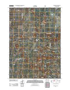
2011 Map of Bear Butte
USGS Topo · Published 2011About this map
Bear Butte and its surrounding high-country peaks dominate this Klamath County landscape, reflecting the volcanic and grazing history of south-central Oregon. The map documents a network of forest roads and resource-management features, including the Bear Butte Lookout and the Long Prairie Corral, which speak to the area's long-standing use for timber and livestock. A series of prominent landforms like Doeskin Butte, Buckskin Butte, and Little Yamsay Mountain are drained by a complex system of waterways such as Doe Creek, Dillon Creek, and the multiple branches of Rock Creek. The isolated Porter Ranch sits near Bear Flat, marking one of the few named private holdings in this terrain. This 2011 survey, compiled by the U.S. Geological Survey, captures the topographical intersection of fire lookouts, high meadows like Deely Meadow, and the vital Silver Lake Rd corridor.
Find a feature on this map
22 named features on this map. Tap any name to fly to it.
Don’t see what you’re looking for? This feature index may not catch every label — zoom into the map to look around manually.
Map Details
Editions of this 2011 Bear Butte Map
This is the sole edition of this map. No revisions or reprints were ever made.
Other maps of this area

1889 · Klamath
USGS Topo · 1:250,000

1894 · Klamath
USGS Topo · 1:250,000

1935 · Chemult
USGS Topo · 1:96,000

1941 · Chemult
USGS Topo · 1:125,000

1955 · Crescent
USGS Topo · 1:250,000

1955 · Klamath Falls
USGS Topo · 1:250,000

1957 · Crescent
USGS Topo · 1:250,000

1957 · Klamath Marsh
USGS Topo · 1:62,500

1958 · Crescent
USGS Topo · 1:250,000

1958 · Klamath Falls
USGS Topo · 1:250,000