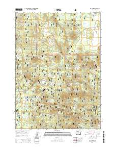
2014 Map of Bear Butte
USGS Topo · Published 2014About this map
Winema National Forest and Fremont National Forest overlap in this high-altitude landscape of south-central Oregon. The terrain is characterized by a series of volcanic features, most notably Bear Butte, Doeskin Butte, and Buckskin Butte, which rise above the surrounding timberland. Water sources are vital but scattered in this volcanic province, appearing as isolated features like Round Lake in the north and Deely Spring in the south. The map documents a complex network of forest development roads, such as Silver Lake Rd, that provide access to the interior. Open clearings like Long Prairie and Deely Meadow contrast with the dense forest cover, while Little Yamsay Mtn anchors the southern boundary of the quadrangle. This 2014 survey serves as a detailed record of land management boundaries and geographic landmarks in the high Cascades plateau.
Find a feature on this map
36 named features on this map. Tap any name to fly to it.
Don’t see what you’re looking for? This feature index may not catch every label — zoom into the map to look around manually.
Map Details
Editions of this 2014 Bear Butte Map
This is the sole edition of this map. No revisions or reprints were ever made.
Other maps of this area

1889 · Klamath
USGS Topo · 1:250,000

1894 · Klamath
USGS Topo · 1:250,000

1935 · Chemult
USGS Topo · 1:96,000

1941 · Chemult
USGS Topo · 1:125,000

1955 · Crescent
USGS Topo · 1:250,000

1955 · Klamath Falls
USGS Topo · 1:250,000

1957 · Crescent
USGS Topo · 1:250,000

1957 · Klamath Marsh
USGS Topo · 1:62,500

1958 · Crescent
USGS Topo · 1:250,000

1958 · Klamath Falls
USGS Topo · 1:250,000