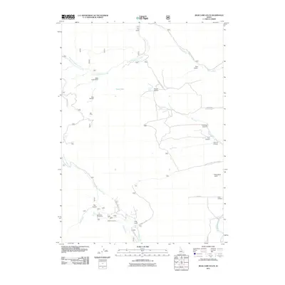
2011 Map of Bear Camp Gulch
USGS Topo · Published 2011About this map
Bear Camp and Pebble Cow Camp anchor this high-elevation landscape in Bannock County, where seasonal grazing and forest management define the local geography. The area is characterized by a dense network of water features and drainages, including Toponce Creek and the North Fork Pebble Creek, which feed into the Portneuf River at the southeastern edge. Forest Service access via Caribou NF Rd 13 and Caribou National Forest Road 3 connects remote landmarks like Horse Lake and the Big Spring Campground. The map reveals a complex system of named canyons and gulches, such as Hornet Canyon, Gooding Canyon, and Wood Road Gulch, illustrating the deeply carved terrain and natural springs that have historically supported ranching operations and outdoor recreation in this corner of Idaho.
Find a feature on this map
34 named features on this map. Tap any name to fly to it.
Don’t see what you’re looking for? This feature index may not catch every label — zoom into the map to look around manually.
Map Details
Editions of this 2011 Bear Camp Gulch Map
This is the sole edition of this map. No revisions or reprints were ever made.
Other maps of this area

1917 · Portneuf
USGS Topo · 1:62,500

1948 · Bancroft
USGS Topo · 1:62,500

1949 · Bancroft
USGS Topo · 1:62,500

1954 · Pocatello
USGS Topo · 1:250,000

1955 · Preston
USGS Topo · 1:250,000

1958 · Pocatello
USGS Topo · 1:250,000

1958 · Preston
USGS Topo · 1:250,000

1962 · Preston
USGS Topo · 1:250,000

1968 · Bear Camp Gulch
USGS Topo · 1:24,000
1968 · South Putnam Mtn
USGS Topo · 1:24,000