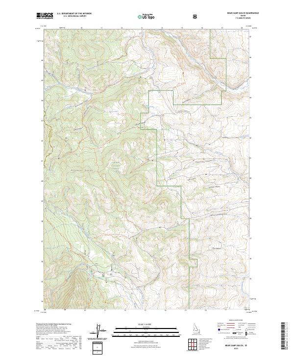
2023 Map of Bear Camp Gulch
USGS Topo · Published 2023About this map
Caribou National Forest dominates this section of the Portneuf Range, where the high-altitude topography of the Idaho backcountry is defined by a dense network of canyons and gulches. The drainage patterns are intricate, with Pebble Creek and the Portneuf River drawing from numerous springs and forks like Big Spring and South Fork Toponce Creek. A robust system of historic trails and forest roads, including the Robbers Roost Trl and Hornet Canyon Trl, provides access to remote landmarks such as Horse Lakes. The map highlights the boundary between Bannock Co and Caribou Co, illustrating how the land was organized into townships and ranges within the national forest system, preserving a landscape that remains primarily defined by its natural water sources like King Creek Spring and Cold Spring.
Find a feature on this map
47 named features on this map. Tap any name to fly to it.
Don’t see what you’re looking for? This feature index may not catch every label — zoom into the map to look around manually.
Map Details
Editions of this 2023 Bear Camp Gulch Map
This is the sole edition of this map. No revisions or reprints were ever made.
Other maps of this area

1917 · Portneuf
USGS Topo · 1:62,500

1948 · Bancroft
USGS Topo · 1:62,500

1949 · Bancroft
USGS Topo · 1:62,500

1954 · Pocatello
USGS Topo · 1:250,000

1955 · Preston
USGS Topo · 1:250,000

1958 · Pocatello
USGS Topo · 1:250,000

1958 · Preston
USGS Topo · 1:250,000

1962 · Preston
USGS Topo · 1:250,000

1968 · Bear Camp Gulch
USGS Topo · 1:24,000
1968 · South Putnam Mtn
USGS Topo · 1:24,000