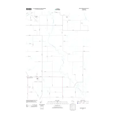
2013 Map of Bear Creek
USGS Topo · Published 2013About this map
The Embarrass River meanders southward through this rural Waupaca County landscape, forming complex oxbows and wetlands that define the local geography. In the southern portion of the map, the settlements of Bear Creek Corners and Bear Creek serve as the primary hubs, situated at the junction of Us-45 and Wi-76. This 2013 survey illustrates the area's transition from agricultural grid roads to more concentrated development near these community centers. Aviation plays a notable role in the local infrastructure, with both the Clintonville Municipal Airport and the smaller Schewe Airport situated in the northern half of the quadrangle. The hydrography is further detailed by the presence of the Pigeon River in the northwest and the Wolf River in the northeast, alongside smaller tributaries like Silver Cr and Bear Cr.
Find a feature on this map
60 named features on this map. Tap any name to fly to it.
Don’t see what you’re looking for? This feature index may not catch every label — zoom into the map to look around manually.
Map Details
Editions of this 2013 Bear Creek Map
This is the sole edition of this map. No revisions or reprints were ever made.
Other maps of this area

1955 · Embarrass
USGS Topo · 1:48,000

1955 · Clintonville
USGS Topo · 1:48,000

1955 · Green Bay
USGS Topo · 1:250,000

1956 · New London
USGS Topo · 1:48,000

1956 · Weyauwega
USGS Topo · 1:48,000

1969 · New London
USGS Topo · 1:24,000

1969 · Northport
USGS Topo · 1:24,000

1969 · Leeman
USGS Topo · 1:24,000

1969 · Embarrass
USGS Topo · 1:24,000

1969 · Lunds
USGS Topo · 1:24,000