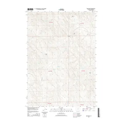
2015 Map of Bear Draw
USGS Topo · Published 2015About this map
Fleetwood Reservoir and a series of smaller catchment basins define the water management strategy of this high plains landscape in Johnson County. This 2015 survey reveals a terrain carved by numerous drainage systems, including Stewart Draw, McCray Draw, and the eponymous Bear Draw. These features, alongside Coal Gulch, illustrate the complex erosion patterns and hydrological features of the region during the early 21st century.
Find a feature on this map
21 named features on this map. Tap any name to fly to it.
Don’t see what you’re looking for? This feature index may not catch every label — zoom into the map to look around manually.
Map Details
Editions of this 2015 Bear Draw Map
This is the sole edition of this map. No revisions or reprints were ever made.
Other maps of this area

1955 · Sheridan
USGS Topo · 1:250,000

1958 · Sheridan
USGS Topo · 1:250,000

1962 · Sheridan
USGS Topo · 1:250,000

1972 · Mitchell Draw
USGS Topo · 1:24,000
1972 · Crazy Woman Ranch
USGS Topo · 1:24,000
1972 · Ploessers Draw
USGS Topo · 1:24,000
1972 · Pine Gulch
USGS Topo · 1:24,000
1972 · Bear Draw
USGS Topo · 1:24,000
1972 · Somerville Flats West
USGS Topo · 1:24,000
1972 · Floate Draw
USGS Topo · 1:24,000