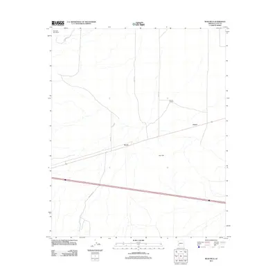
2011 Map of Bear Hills
USGS Topo · Published 2011About this map
Brenda and the smaller settlement of Pioneer sit along the primary east-west corridor of this arid Arizona landscape. The terrain is defined by the Bear Hills to the south and the Plomosa Mountains rising in the northwest, creating a wide basin floor crossed by numerous ephemeral washes. This 2011 survey by the U.S. Geological Survey captures the modern transport network of La Paz County, where long-established routes like Stagecoach Rd and Ramsey Mine Rd hint at the region's earlier mining and transit history. The scarcity of permanent water is underscored by landmarks like Plomosa Windmill, which serves as a vital point of reference in an otherwise open desert expanse managed through a grid of numbered roads including Avenue 41 E and Avenue 42 E.
Find a feature on this map
11 named features on this map. Tap any name to fly to it.
Don’t see what you’re looking for? This feature index may not catch every label — zoom into the map to look around manually.
Map Details
Editions of this 2011 Bear Hills Map
This is the sole edition of this map. No revisions or reprints were ever made.
Other maps of this area

1930 · Linskey
USGS Topo · 1:62,500

1942 · Blythe
USGS Topo · 1:250,000

1942 · Vicksburg
USGS Topo · 1:250,000

1954 · Salton Sea
USGS Topo · 1:250,000

1954 · Phoenix
USGS Topo · 1:250,000

1955 · Salton Sea
USGS Topo · 1:250,000

1957 · Phoenix
USGS Topo · 1:250,000

1958 · Phoenix
USGS Topo · 1:250,000

1959 · Salton Sea
USGS Topo · 1:250,000

1960 · Phoenix
USGS Topo · 1:250,000