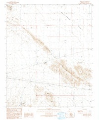
1990 Map of Bear Hills
USGS Topo · Published 1990About this map
Bear Hills rise above the arid expanse of the Ranegras Plain, serving as a focal point for mineral exploration and desert infrastructure in this corner of Arizona. The small settlement of Brenda and a nearby Trailer Park represent the primary residential footprint, while the surrounding landscape is defined by its industrial utility. A network of 4wd tracks connects numerous mining sites, including the Shamrock Mine, Republic Mine, and the Ramsey Mine Shafts.
Find a feature on this map
23 named features on this map. Tap any name to fly to it.
Don’t see what you’re looking for? This feature index may not catch every label — zoom into the map to look around manually.
Map Details
Editions of this 1990 Bear Hills Map
This is the sole edition of this map. No revisions or reprints were ever made.
Other maps of this area

1930 · Linskey
USGS Topo · 1:62,500

1942 · Blythe
USGS Topo · 1:250,000

1942 · Vicksburg
USGS Topo · 1:250,000

1954 · Salton Sea
USGS Topo · 1:250,000

1954 · Phoenix
USGS Topo · 1:250,000

1955 · Salton Sea
USGS Topo · 1:250,000

1957 · Phoenix
USGS Topo · 1:250,000

1958 · Phoenix
USGS Topo · 1:250,000

1959 · Salton Sea
USGS Topo · 1:250,000

1960 · Phoenix
USGS Topo · 1:250,000