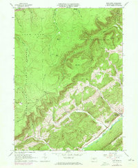
1962 Map of Bear Knob
USGS Topo · Published 1972About this map
Unionville (Fleming PO) sits along the southeastern edge of this topographic study, where the valley floor meets the steep rise of Bald Eagle Mountain. This area of Centre County is defined by the sharp transition between the agricultural lands of the Eagle Creek corridor and the high, forested plateaus of the Snow Shoe State Forest. Local landmarks such as the Oak Ridge Cem, Bush Hollow Ch, and Dicks Run Ch are preserved alongside the infrastructure of the Penn Central railroad, which follows the creek through the valley.
Find a feature on this map
44 named features on this map. Tap any name to fly to it.
Don’t see what you’re looking for? This feature index may not catch every label — zoom into the map to look around manually.
Map Details
Editions of this 1962 Bear Knob Map
2 editions found
Other maps of this area

1908 · Bellefonte
USGS Topo · 1:62,500

1909 · Bellefonte
USGS Topo · 1:62,500

1922 · Philipsburg
USGS Topo · 1:62,500

1928 · Snow Shoe
USGS Topo · 1:48,000

1929 · Karthaus
USGS Topo · 1:62,500

1931 · Show Shoe
USGS Topo · 1:62,500

1932 · Karthaus
USGS Topo · 1:62,500

1939 · Philipsburg
USGS Topo · 1:62,500

1943 · Lewistown
USGS Topo · 1:125,000

1945 · Philipsburg
USGS Topo · 1:62,500