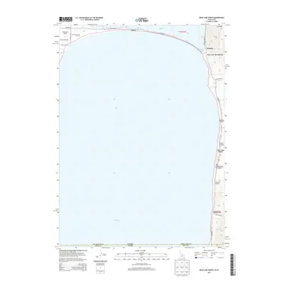
2013 Map of Bear Lake North
USGS Topo · Published 2013About this map
Bear Lake dominates this northern shoreline survey, straddling the state line between Idaho and Utah. The northern tip of the lake is defined by the Lifton settlement and the Saint Charles Creek Fish Trap, situated just south of Mud Lake. Along the eastern shore, the topography rises sharply toward Lake Ridge, carved by numerous drainages including Bee Hunt Hollow, Cooley Canyon, and Chokecherry Hollow. Local travel in this period relied on the E Shore Rd and the historic Turnpike near the Idaho-Utah border. The map documents recreation and small settlements concentrated along the water's edge, most notably at Bear Lake Hot Springs and Bear Lake Sands. This 2013 perspective shows the established access points and named terrain features of the Bear Lake Valley before more modern developments altered the landscape.
Find a feature on this map
28 named features on this map. Tap any name to fly to it.
Don’t see what you’re looking for? This feature index may not catch every label — zoom into the map to look around manually.
Map Details
Editions of this 2013 Bear Lake North Map
This is the sole edition of this map. No revisions or reprints were ever made.
Other maps of this area

1909 · Montpelier
USGS Topo · 1:125,000

1911 · Montpelier
USGS Topo · 1:125,000

1912 · Randolph
USGS Topo · 1:125,000

1954 · Ogden
USGS Topo · 1:250,000

1955 · Preston
USGS Topo · 1:250,000

1958 · Ogden
USGS Topo · 1:250,000

1958 · Preston
USGS Topo · 1:250,000

1960 · Ogden
USGS Topo · 1:250,000

1962 · Preston
USGS Topo · 1:250,000

1967 · Paris
USGS Topo · 1:24,000