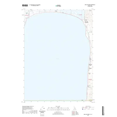
2020 Map of Bear Lake North
USGS Topo · Published 2020About this map
Bear Lake dominates the center of this landscape, its expansive waters framed by a narrow eastern shoreline and the northern marshlands of Bear Lake Valley. Along the northern edge, the small settlement of Lifton sits near the mouth of Little Creek, while the eastern shore is defined by a series of drainages and recreation points. The topography rises sharply from the water's edge into Lake Ridge, cut by named features such as Cooley Canyon, Porcupine Hollow, and Peterson Hollow.
Find a feature on this map
28 named features on this map. Tap any name to fly to it.
Don’t see what you’re looking for? This feature index may not catch every label — zoom into the map to look around manually.
Map Details
Editions of this 2020 Bear Lake North Map
This is the sole edition of this map. No revisions or reprints were ever made.
Other maps of this area

1909 · Montpelier
USGS Topo · 1:125,000

1911 · Montpelier
USGS Topo · 1:125,000

1912 · Randolph
USGS Topo · 1:125,000

1954 · Ogden
USGS Topo · 1:250,000

1955 · Preston
USGS Topo · 1:250,000

1958 · Ogden
USGS Topo · 1:250,000

1958 · Preston
USGS Topo · 1:250,000

1960 · Ogden
USGS Topo · 1:250,000

1962 · Preston
USGS Topo · 1:250,000

1967 · Paris
USGS Topo · 1:24,000