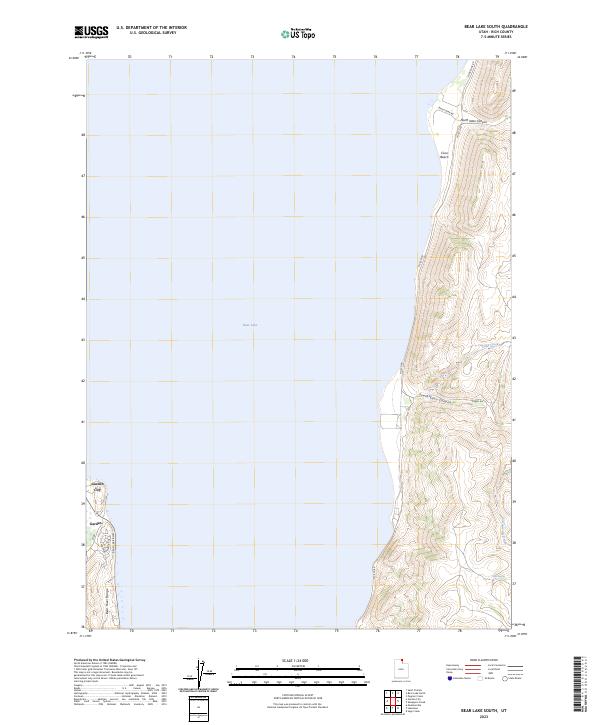
2023 Map of Bear Lake South
USGS Topo · Published 2023About this map
Bear Lake dominates the central and western portion of this landscape, its expansive waters framed by the rising elevations of the Bear River Range to the west and the carved topography of the eastern shore. The settlement of Garden City and the neighboring area of Garden serve as the primary hubs on the western edge, where roads like Bear Lake Blvd and Mayfly Ave reflect the residential and recreational development of this high-altitude basin. Across the water, the eastern shore is defined by a more dramatic and less densely populated terrain. Notable landmarks include the recreational area of Cisco Beach and the deep incisions of North Eden Canyon and South Eden Canyon. This topographical survey captures the tension between the developed lakeside communities and the steep, rugged slopes where seasonal drainages such as Little Creek and Cottonwood Creek flow toward the lake's turquoise depths.
Find a feature on this map
19 named features on this map. Tap any name to fly to it.
Don’t see what you’re looking for? This feature index may not catch every label — zoom into the map to look around manually.
Map Details
Editions of this 2023 Bear Lake South Map
This is the sole edition of this map. No revisions or reprints were ever made.
Other maps of this area

1909 · Montpelier
USGS Topo · 1:125,000

1911 · Montpelier
USGS Topo · 1:125,000

1912 · Randolph
USGS Topo · 1:125,000

1954 · Ogden
USGS Topo · 1:250,000

1955 · Preston
USGS Topo · 1:250,000

1958 · Ogden
USGS Topo · 1:250,000

1958 · Preston
USGS Topo · 1:250,000

1960 · Ogden
USGS Topo · 1:250,000

1962 · Preston
USGS Topo · 1:250,000

1969 · Sheeppen Creek
USGS Topo · 1:24,000