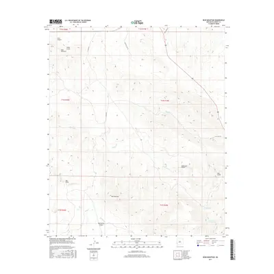
2017 Map of Bear Mountain
USGS Topo · Published 2017About this map
Bear Mountain dominates the southern reaches of this landscape, rising above a complex network of seasonal drainage channels and high-desert canyons. The area is defined by the steep relief of the Mule Mountains and significant topographical transitions, such as those found in Bear Valley and Henderson Canyon. Water management is a visible priority in this arid Grant County environment, evidenced by livestock or irrigation infrastructure like the Lower Goat Canyon Tank, Upper Goat Canyon Tank, and Mallet Pond. Local travel across these townships is facilitated by rural routes including Moon Ranch Rd and H-Y Ranch Rd. The map also reveals numerous intermittent streams, most notably Buckhorn Cr and Duck Cr, which have carved out distinctive features like Mud Spring Canyon and Troffer Canyon.
Find a feature on this map
26 named features on this map. Tap any name to fly to it.
Don’t see what you’re looking for? This feature index may not catch every label — zoom into the map to look around manually.
Map Details
Editions of this 2017 Bear Mountain Map
This is the sole edition of this map. No revisions or reprints were ever made.
Other maps of this area

1910 · Mogollon
USGS Topo · 1:125,000

1912 · Mogollon
USGS Topo · 1:125,000

1954 · Silver City
USGS Topo · 1:250,000

1954 · Clifton
USGS Topo · 1:250,000

1957 · Clifton
USGS Topo · 1:250,000

1958 · Silver City
USGS Topo · 1:250,000

1958 · Clifton
USGS Topo · 1:250,000

1959 · Steeple Rock
USGS Topo · 1:62,500

1959 · Cliff
USGS Topo · 1:62,500

1962 · Silver City
USGS Topo · 1:250,000