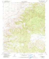
1966 Map of Bear Mountain
USGS Topo · Published 1985About this map
El Tejon dominates the western slopes of this terrain, where the landscape transitions into the rugged heights of Bear Mtn. The 1966 survey, later photoinspected in the early 1970s, reveals a network of infrastructure supporting the remote ranching and water management needs of Kern County. Evidence of mid-century industrial development is clear through the prominent Pipeline corridors and various Water Tanks scattered across the high country.
Find a feature on this map
18 named features on this map. Tap any name to fly to it.
Don’t see what you’re looking for? This feature index may not catch every label — zoom into the map to look around manually.
Map Details
Editions of this 1966 Bear Mountain Map
3 editions found
Other maps of this area

1914 · Caliente
USGS Topo · 1:125,000

1929 · Bena
USGS Topo · 1:31,680

1930 · Bear Mountain
USGS Topo · 1:31,680

1930 · Arvin
USGS Topo · 1:31,680

1931 · Edison
USGS Topo · 1:31,680

1931 · Tejon Hills
USGS Topo · 1:31,680

1932 · Bena
USGS Topo · 1:31,680

1933 · Arvin
USGS Topo · 1:31,680

1933 · Tejon Hills
USGS Topo · 1:31,680

1933 · Bear Mountain
USGS Topo · 1:31,680