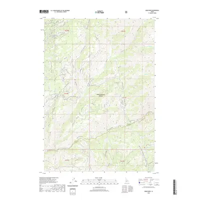
2020 Map of Bear River
USGS Topo · Published 2020About this map
Boise National Forest encompasses this high-elevation terrain where the North Fork Boise River serves as a primary drainage for numerous steep creeks. The landscape is defined by the convergence of the Bear River and the Crooked River, with the latter featuring the Crooked Pike Loop near the northern boundary. Prominent elevations like Grand Mountain and the expansive Swanholm Ridge overlook a network of specialized forest service roads, such as Hunter-Cr-Crooked River, which provide access to remote areas like Jennie Lake and Bear Summit. Historical nomenclature persists in names like Robert E Lee Creek and Horse Heaven Creek. The map documents a rugged wilderness where modern resource management roads intersect with traditional pack trails and riparian corridors like Steamboat Creek and Willow Creek, reflecting the area's ongoing use for forestry and back-country recreation.
Find a feature on this map
52 named features on this map. Tap any name to fly to it.
Don’t see what you’re looking for? This feature index may not catch every label — zoom into the map to look around manually.
Map Details
Editions of this 2020 Bear River Map
This is the sole edition of this map. No revisions or reprints were ever made.
Other maps of this area

1891 · Bear Valley
USGS Topo · 1:125,000

1893 · Bear Valley
USGS Topo · 1:125,000

1894 · Idaho Basin
USGS Topo · 1:125,000

1894 · Rocky Bar
USGS Topo · 1:125,000

1909 · Garden Valley
USGS Topo · 1:125,000

1955 · Hailey
USGS Topo · 1:250,000

1957 · Challis
USGS Topo · 1:250,000

1959 · Hailey
USGS Topo · 1:250,000

1960 · Challis
USGS Topo · 1:250,000

1962 · Hailey
USGS Topo · 1:250,000