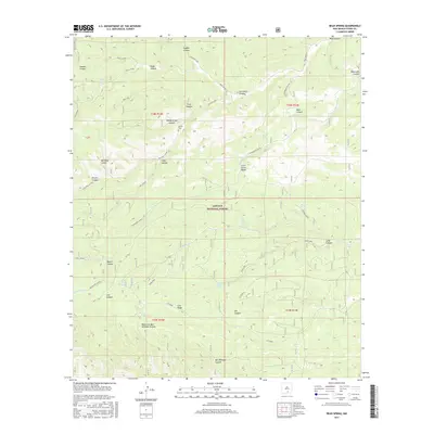
2017 Map of Bear Spring
USGS Topo · Published 2017About this map
Lincoln National Forest encompasses the high country of the Sacramento Mountains in this 2017 survey of Otero County. The landscape is defined by an intricate network of drainages including Bluewater Canyon, Jim Lewis Canyon, and Sleepy Grass Canyon. These deep relief features provide a clear record of the region's hydrography, marked by critical water sources such as Bear Spring, McEwan Spring, and Cecil Smith Water. Evidence of early settlement and land use is visible at Jeffers Cem, situated near Jeffers Spring in the northern portion of the quadrangle. The naming of features like Ben Williams Canyon and West Fork Ben Williams Canyon suggests a history of localized family ranching or homesteading in these canyons. Transportation is limited to a sparse network of forest roads and trails that traverse high points like Lick Ridge.
Find a feature on this map
36 named features on this map. Tap any name to fly to it.
Don’t see what you’re looking for? This feature index may not catch every label — zoom into the map to look around manually.
Map Details
Editions of this 2017 Bear Spring Map
This is the sole edition of this map. No revisions or reprints were ever made.
Other maps of this area

1952 · Cloudcroft
USGS Topo · 1:62,500

1954 · Carlsbad
USGS Topo · 1:250,000

1958 · Carlsbad
USGS Topo · 1:250,000

1963 · Woodson Canyon
USGS Topo · 1:24,000

1965 · Bear Spring
USGS Topo · 1:24,000

1965 · Surveyors Canyon
USGS Topo · 1:24,000

1965 · Avis
USGS Topo · 1:24,000

1965 · Rogers Ruins
USGS Topo · 1:24,000

1965 · El Paso Canyon
USGS Topo · 1:24,000

1965 · Pinon
USGS Topo · 1:24,000