
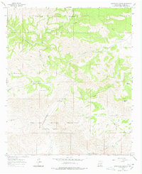
1965 Map of Surveyors Canyon
USGS Topo · Published 1968About this map
The Fort Bliss Military Reservation (Mc Gregor Missile Range) dominates the southern portion of this high-altitude landscape, marking a transition from public lands into restricted defense territory during the mid-1960s. To the north, the protected timberlands of the Lincoln National Forest cover the ridges and deep drainages. The Sacramento River carves through the center of the terrain, joined by a complex network of canyons including Surveyors Canyon, East McAfee Canyon, and Wayland Canyon. This rugged geography is defined by its water management features, where artificial structures like Crest Garden Tank, Kimmons Tank, and Stevens Lake provide essential collection points in an arid environment. Near Chatfield Peak, the land is deeply etched by Chatfield Canyon, reflecting a wilderness area utilized for both military testing and national forest conservation.
Find a feature on this map
16 named features on this map. Tap any name to fly to it.
Don’t see what you’re looking for? This feature index may not catch every label — zoom into the map to look around manually.
Map Details
Editions of this 1965 Surveyors Canyon Map
2 editions found
Other maps of this area

1954 · Carlsbad
USGS Topo · 1:250,000

1958 · Carlsbad
USGS Topo · 1:250,000

1963 · Indian Draw
USGS Topo · 1:24,000

1965 · Bear Spring
USGS Topo · 1:24,000

1965 · Avis
USGS Topo · 1:24,000

1965 · Rogers Ruins
USGS Topo · 1:24,000

1965 · El Paso Canyon
USGS Topo · 1:24,000

1965 · Pinon
USGS Topo · 1:24,000

1979 · Alamogordo
USGS Topo · 1:100,000

1979 · Crow Flats
USGS Topo · 1:100,000