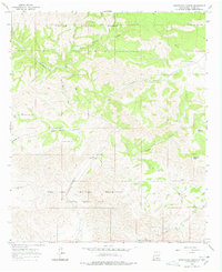
1965 Map of Surveyors Canyon
USGS Topo · Published 1978About this map
The Lincoln National Forest meets the northern boundary of the Fort Bliss Military Reservation (McGregor Missile Range) in this mid-1960s survey of Otero County. The landscape is defined by the drainage patterns of the Sacramento River, which cuts through the southern portion of the quadrangle, and the intricate network of canyons including Surveyors Canyon, East McAfee Canyon, and Wayland Canyon. This map captures a remote high-altitude transition where livestock management features like Kimmons Tank and Crest Garden Tank dot the terrain alongside more permanent water sources like Stevens Lake. The inclusion of the McGregor Missile Range underscores the mid-century expansion of military training and testing grounds into the western wilderness. Prominent elevations such as Chatfield Peak provide landmarks for navigating the steep draws and forks that characterize this part of the Sacramento Mountains.
Find a feature on this map
19 named features on this map. Tap any name to fly to it.
Don’t see what you’re looking for? This feature index may not catch every label — zoom into the map to look around manually.
Map Details
Editions of this 1965 Surveyors Canyon Map
2 editions found
Other maps of this area

1954 · Carlsbad
USGS Topo · 1:250,000

1958 · Carlsbad
USGS Topo · 1:250,000

1963 · Indian Draw
USGS Topo · 1:24,000

1965 · Bear Spring
USGS Topo · 1:24,000

1965 · Surveyors Canyon
USGS Topo · 1:24,000

1965 · Avis
USGS Topo · 1:24,000

1965 · Rogers Ruins
USGS Topo · 1:24,000

1965 · El Paso Canyon
USGS Topo · 1:24,000

1965 · Pinon
USGS Topo · 1:24,000

1979 · Alamogordo
USGS Topo · 1:100,000