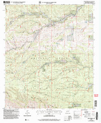
2004 Map of Bear Spring
USGS Topo · Published 2006About this map
Lincoln National Forest dominates this section of the Sacramento Mountains, characterized by an intricate network of drainages and high-elevation water sources. The Jeffers Cemetery and Welch Lodge indicate localized settlement and land use within the rugged canyon systems. Key water features like Bear Spring, Jeffers Spring, and Bluewater Creek provide vital hydration points in this arid landscape, supplemented by livestock tanks such as Lick Trick Tank and Upper Long Tank.
Find a feature on this map
33 named features on this map. Tap any name to fly to it.
Don’t see what you’re looking for? This feature index may not catch every label — zoom into the map to look around manually.
Map Details
Editions of this 2004 Bear Spring Map
This is the sole edition of this map. No revisions or reprints were ever made.
Other maps of this area

1952 · Cloudcroft
USGS Topo · 1:62,500

1954 · Carlsbad
USGS Topo · 1:250,000

1958 · Carlsbad
USGS Topo · 1:250,000

1963 · Woodson Canyon
USGS Topo · 1:24,000

1965 · Bear Spring
USGS Topo · 1:24,000

1965 · Surveyors Canyon
USGS Topo · 1:24,000

1965 · Avis
USGS Topo · 1:24,000

1965 · Rogers Ruins
USGS Topo · 1:24,000

1965 · El Paso Canyon
USGS Topo · 1:24,000

1965 · Pinon
USGS Topo · 1:24,000