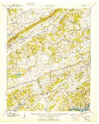
1940 Map of Bearden
USGS Topo · Published 1951About this map
Blackoak Ridge and Hinds Ridge dominate the landscape of Knox County in this 1940 survey, published by the Tennessee Valley Authority. The map documents a rural corridor on the cusp of change, where small settlements like Byington and Ball Camp are connected by the Louisville and Nashville Road and the Southern railroad line. Local life is centered around numerous country institutions, including Grace Ch, Happy Home Sch, and Blue Grass Sch.
Find a feature on this map
65 named features on this map. Tap any name to fly to it.
Don’t see what you’re looking for? This feature index may not catch every label — zoom into the map to look around manually.
Map Details
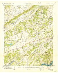
Editions of this 1940 Bearden Map
2 editions found
Other maps of this area

1886 · Knoxville
USGS Topo · 1:125,000

1892 · Knoxville
USGS Topo · 1:125,000

1893 · Briceville
USGS Topo · 1:125,000

1894 · Knoxville
USGS Topo · 1:125,000

1895 · Loudon
USGS Topo · 1:125,000

1895 · Briceville
USGS Topo · 1:125,000

1895 · Knoxville
USGS Topo · 1:125,000

1896 · Briceville
USGS Topo · 1:125,000

1897 · Maynardville
USGS Topo · 1:125,000

1900 · Maynardville
USGS Topo · 1:125,000